Spending time yesterday at the Ordnance Survey partner day reminded me of how many different location-based datasets we use across our client base. At Integrated Skills Limited (ISL), we pride ourselves on delivering cutting-edge route optimisation and address validation solutions across a diverse range of sectors. Our success in achieving operational excellence for our clients—whether in waste and recycling collection, street cleaning, winter maintenance, parcel and postal delivery, drinks distribution, or energy meter reading—is underpinned by our strong partnership with Ordnance Survey (OS).
For a route optimisation specialist, one would expect our solutions to consume the highways related data (street attributes, road speeds, driving restrictions, etc) but, as our solution can cope with mixed mode routing (drive/walk/cycle) we also use the data relates to paths (as many a meter reader and postal operative will walk/cycle them). Not to mention (again) we can incorporate ferry crossing into our route plans! However, on occasions, we also validate addresses and locations prior to creating optimised routes. This blog explores the OS data sets we use to provide solutions to our client base.

Ordnance Survey is the national mapping agency for Great Britain, renowned for its highly accurate geographic data and location-based intelligence. Our partnership with OS enables us to integrate their premium datasets into our software solutions, providing unparalleled accuracy and efficiency to our customers. Here’s how key OS datasets enhance our services:
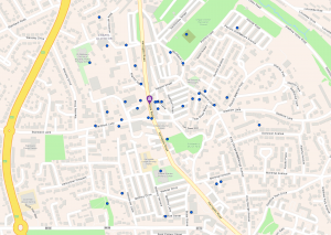
Our route optimisation software can leverage OS MasterMap® Topography Layer for precise geographic detail and OS Highways to incorporate comprehensive road network data. OS Highways includes detailed information on road restrictions, classifications, and turn restrictions, ensuring that our route planning accounts for the real-world complexities of urban and rural environments.
In sectors such as parcel delivery, postal services, and energy meter reading, ensuring that the correct address is serviced is critical. We integrate OS AddressBase®, which provides accurate and up-to-date property-level data. This ensures that our address validation solutions can precisely match addresses and geocode them for efficient service delivery, reducing missed appointments and delivery errors. For some clients we also use Code-Point® – a postcode locator with postcode units in Great Britain and Northern Ireland. Coverage includes over 1.7 million postcodes in Great Britain and Northern Ireland updated quarterly – the most authoritative and accurate depiction of all live postcodes.
For waste collection, street cleaning, and winter maintenance services, understanding administrative boundaries is crucial. We use OS Boundary-Line to define local authority boundaries accurately and OS Open Map – Local to enhance our spatial analysis for effective service planning. These datasets ensure that no area is overlooked, and resources are allocated effectively.
OS Open Roads data provides a simplified but detailed view of the national road network, which is particularly useful for managing large-scale operations like winter gritting and postal delivery. It allows us to optimise routes by understanding road connectivity and ensuring efficient vehicle movement across service areas.
The OS NGD is a single store of all Ordnance Survey’s authoritative data for Great Britain. The OS NGD delivers the richest data available for optimum analysis and application to route planning challenges.
Our use of Ordnance Survey data plays a critical role in improving outcomes across multiple sectors:
By integrating Ordnance Survey’s datasets, we ensure that our clients experience tangible benefits such as:
Our collaboration with Ordnance Survey empowers us to continuously innovate and adapt our solutions to meet evolving industry demands. With OS’s commitment to data excellence and our expertise in delivering World leading route and address validation solutions, we remain at the forefront of operational efficiency for our clients.
As we look to the future, we are excited to explore new opportunities to apply Ordnance Survey’s NGD to further enhance the functionality and accuracy of our solutions, driving long-term success for the industries we serve.
Would you like to know more about Delivering Efficiency and Accuracy in Route Planning: The Vital Role of Our Partnership with Ordnance Survey? Fill in your details below and let us know how we can help.
© 2025 Suite 3A, Chapel Allerton House, 114 Harrogate Road, Leeds, LS7 4NY
ukinfo@integrated-skills.com | +44 (0) 3300 888 670
Website Designed & Built by we are CODA